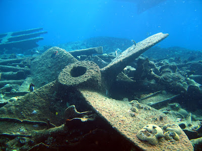
Surveys of Protected Diving Areas underway
 The propeller of the ship wreck of the "Cristobal Colon", which is now a
Buoyed Marine Protected Area for divers near North Rock, Bermuda.
The BREAM team has been busy since mid-October braving high winds and stormy seas to survey all of the Buoyed Dive Site Protected Areas, as part of a project funded by the Department of Conservation Services, the Bermuda Zoological Society, the Atlantic Conservation Partnership, and the Overseas Territories Environmental Programme of the Foreign and Commonwealth Office of the UK Govt.
We are using the AGRRA protocol to assess the corals, other benthic animals, and fishes, and the REEF fish survey protocol to gain additional information about fishes at each location.
 Yellow dots in the map above show the locations of the
Buoyed Protected Dive Sites we are presently surveying
(click image to enlarge)


Comments